

Myth of arbitrary boundaries


Conventional wisdom has it that the political map of Africa as we know it today was solely determined at the Berlin Conference of 1884 to 1885 by European actors who knew little about conditions on the ground, with the process involving no African input.
For the uninitiated, the Berlin Conference – convened by Germany’s first chancellor, Otto von Bismarck, from November 15, 1884, to February 26, 1885 – culminated in the colonial partitioning of Africa among the major European powers.
The carving up of Africa was problematic in many respects. For one, we have in many parts of the continent adjoining communities that are separated from their kith and kin by what appear to be arbitrary international borders. In our Southern African neck of the woods, we have Vendas on either side of the Limpopo – in Zimbabwe and South Africa. Ditto the Tutsis and Hutus, who inhabit Burundi, Rwanda and the Democratic Republic of Congo (DRC). I could go on. The divided communities share not only the same language but also strong historical and cultural ties.
The Berlin Conference may have exemplified the height of European greed and shamelessness at the time, but its impact on African national borders was not that substantial, if a newly published study is anything to go by.
Authored by scholars from the universities of Emory, Washington and Loyola – all in the US – and published in the peer-reviewed American Political Science Review journal last month, the study concludes that “Africa was not only not divided at Berlin, but the subject [of dividing the continent among colonial powers] was not even on the agenda”.
The only borders drawn up at Berlin were for the Congo Free State, the present-day DRC, but most of these were later revised.
According to the study, by the late 1880s, Europeans had yet to draw up any borders, even preliminary ones, for most of Africa, with this being particularly so in the interior of the continent. Indeed, initial and final border formation occurred between 1891 and 1908. That was because initial borders were adjusted as the Europeans learned about and adjusted to the situation on the ground.
It’s worth noting that, at Berlin, the European powers agreed on the principle of suzerainty, whereby a power that signed a recognised treaty with an African ruler gained all the territory within the domain that the ruler claimed to be his.
The European powers embraced the principle of suzerainty because, while they had self- interested motives to claim African territory, they sought to avoid conflict among themselves to mimimise the cost of imperial expansion. Thus, they draw up Africa’s colonial borders consciously rather that haphazardly. To do this, they required as much information as possible about a territory, which facilitated African input, as African rulers, for example, had greater knowledge of their claimed domains. In some cases, Africans actually participated directly in negotiations that determined Africa’s national boundaries as we know them today.
The principle of suzerainty generally and the involvement of African rulers in particular meant that pre-existing borders played a role in determining colonial borders. As the study shows, historical political frontiers directly affected 62% of all bilateral borders on the continent, while precolonial African States directly affected 47 bilateral borders.
To bolster the hypothesis that African border formation was not a haphazard affair – which would have seen the grey suits sitting in Berlin simply draw up straight-line frontiers – the authors demonstrate that straight lines that follow latitudinal or longitudinal lines are a feature of only 37% of Africa’s bilateral borders. Such borders are mostly found in desert areas with few local features to use as borders.
Instead, most of the borders that emerged were based on local features, including water bodies and mountain ranges. The new study found that 63% of African bilateral borders have water bodies – rivers, lakes or their watersheds – as primary features, with only 8% of borders lacking water bodies entirely as a feature.
Some water bodies formed the limits of some historical African States and subsequently became colonial borders.
Comments
Research Reports
Projects


Latest News

Showroom
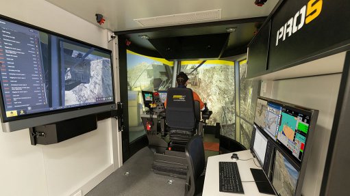
Immersive Technologies is the world's largest, proven and tested supplier of simulator training solutions to the global resources industry.
VISIT SHOWROOM
FlameBlock is a proudly South African company that engineers, manufactures and supplies fire intumescent and retardant products to the fire...
VISIT SHOWROOM

Press Office
Announcements
What's On
Subscribe to improve your user experience...
Option 1 (equivalent of R125 a month):
Receive a weekly copy of Creamer Media's Engineering News & Mining Weekly magazine
(print copy for those in South Africa and e-magazine for those outside of South Africa)
Receive daily email newsletters
Access to full search results
Access archive of magazine back copies
Access to Projects in Progress
Access to ONE Research Report of your choice in PDF format
Option 2 (equivalent of R375 a month):
All benefits from Option 1
PLUS
Access to Creamer Media's Research Channel Africa for ALL Research Reports, in PDF format, on various industrial and mining sectors
including Electricity; Water; Energy Transition; Hydrogen; Roads, Rail and Ports; Coal; Gold; Platinum; Battery Metals; etc.
Already a subscriber?
Forgotten your password?
Receive weekly copy of Creamer Media's Engineering News & Mining Weekly magazine (print copy for those in South Africa and e-magazine for those outside of South Africa)
➕
Recieve daily email newsletters
➕
Access to full search results
➕
Access archive of magazine back copies
➕
Access to Projects in Progress
➕
Access to ONE Research Report of your choice in PDF format
RESEARCH CHANNEL AFRICA
R4500 (equivalent of R375 a month)
SUBSCRIBEAll benefits from Option 1
➕
Access to Creamer Media's Research Channel Africa for ALL Research Reports on various industrial and mining sectors, in PDF format, including on:
Electricity
➕
Water
➕
Energy Transition
➕
Hydrogen
➕
Roads, Rail and Ports
➕
Coal
➕
Gold
➕
Platinum
➕
Battery Metals
➕
etc.
Receive all benefits from Option 1 or Option 2 delivered to numerous people at your company
➕
Multiple User names and Passwords for simultaneous log-ins
➕
Intranet integration access to all in your organisation
